The Castello Plan: The Map used to rebuild New Amsterdam
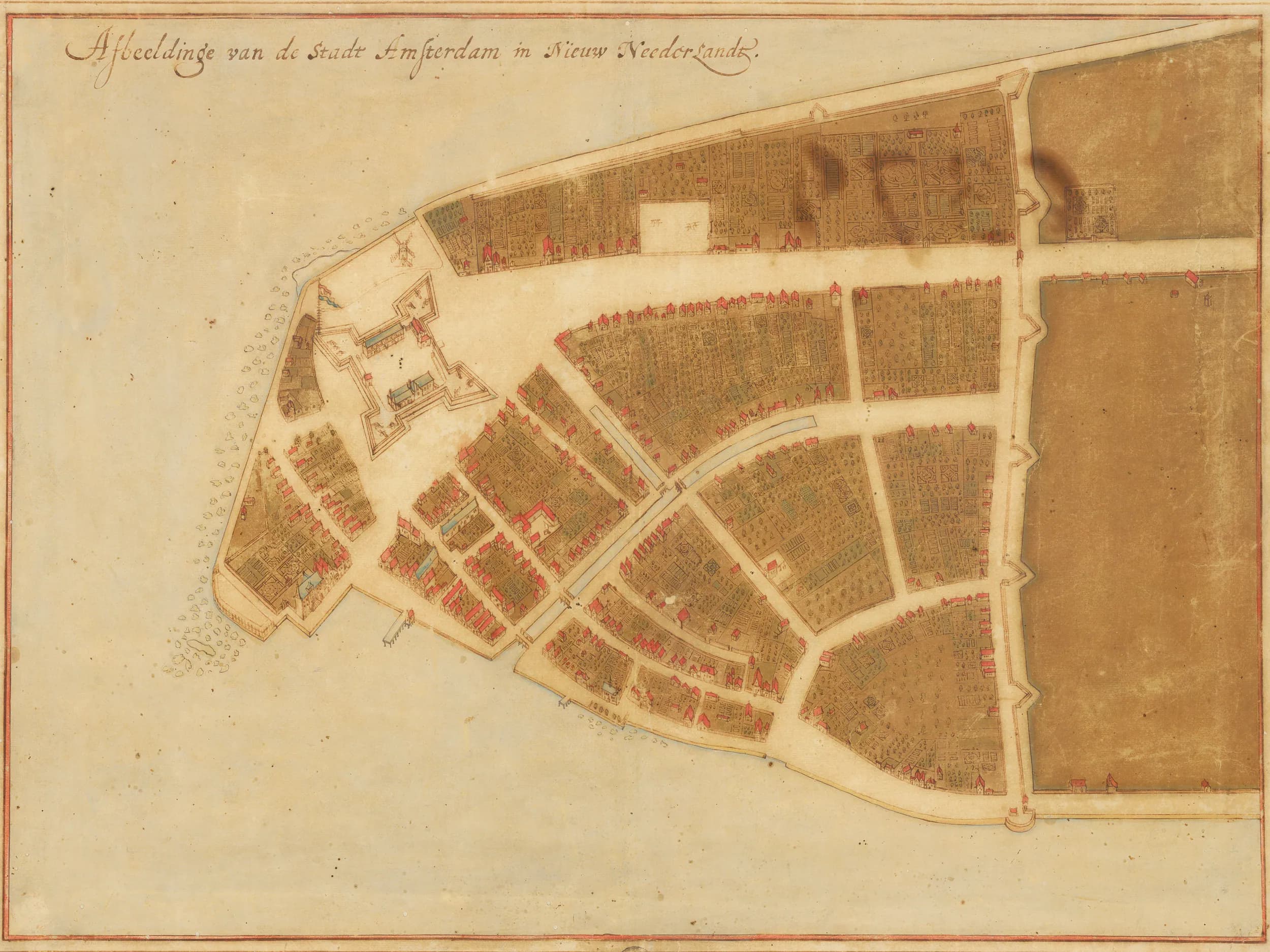
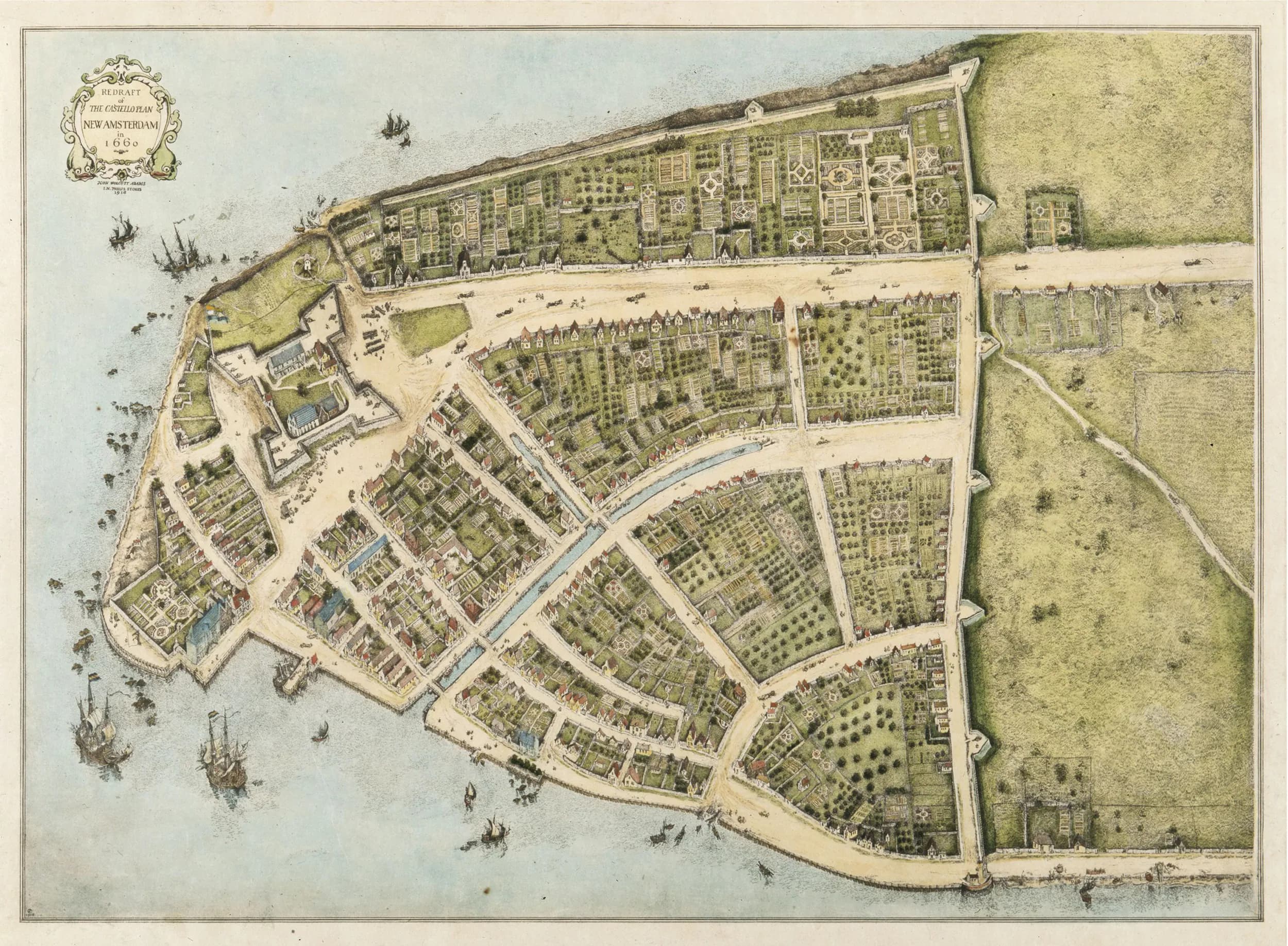
How can anyone know what a city looked like four hundred years ago, when almost every building is gone? For New Amsterdam, the answer is a single remarkable document: a map called the Castello Plan, drawn in 1660. It is the earliest known map of New York City, and it lies at the base of the reconstruction of New Amsterdam that the New Amsterdam History Center created.
A survey of a small Dutch city
In June 1660 the surveyor Jacques Cortelyou was hired by Peter Stuyvesant and the town's leaders to make a precise survey of New Amsterdam. The result was extraordinary: a view from above showing individual buildings, streets, canals, gardens, docks, the fort, Stuyvesant's own house and the wall along the northern edge. It was the home of roughly fifteen hundred people in about three hundred buildings, drawn in astonishing detail.
Lost, sold, and found in a Tuscan villa
Then the original vanished. Around 1665 an unknown draftsman made a copy, which the celebrated cartographer Joan Blaeu bound into an atlas and sold to Cosimo III de' Medici, Grand Duke of Tuscany, in 1667. There it stayed, forgotten, for more than two centuries. In 1900 it resurfaced at the Villa di Castello, a Medici estate near Florence, and took its name from the place it was found.
A snapshot of a vanished world
What makes the Castello Plan priceless is its timing. It captures New Amsterdam at its Dutch height, just four years before the English seized the colony and renamed it New York in 1664. Because the street pattern of lower Manhattan still echoes that old plan, historians can place long lost buildings with real precision, and even work out who lived in them, people like the interpreter Sara Roelofs.
From map to model
This is where our partners come in. The New Amsterdam History Center and their Mapping Early New York project have turned the Castello Plan into a detailed three dimensional reconstruction, laying the 1660 city over modern Manhattan and rebuilding its houses, gardens and streets. Their research and 3D models are the foundation of the TimeLens New Amsterdam experience.
Stand inside the map
A map can show you a city from above. TimeLens lets you stand inside it. Drawing on the Castello Plan and the History Center's models, you can see New Amsterdam restored all around you, from the fort to the wall, exactly where it stood in 1660.